Thursday, March 17, 2016

Tips for Being Severe Weather Prepared

Please share this post with friends, family, and coworkers. Information provided in this article is very important.

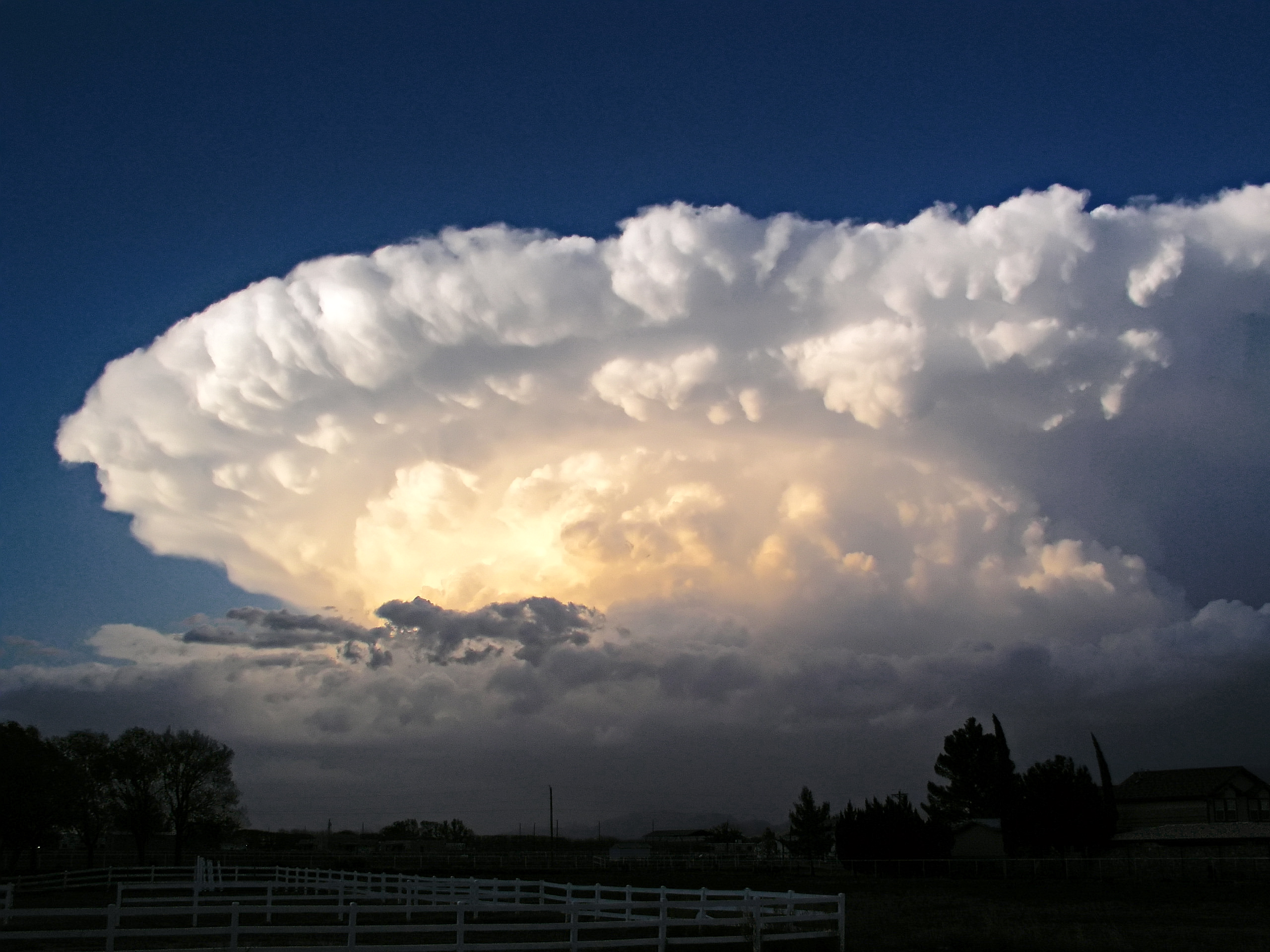
Below is a picture of the sunrise in Carroll County on the way into Kokomo this morning. Although we don't have a wide open ocean or mountains, there is nothing quite like an Indiana sunrise. 


Beautiful Indiana sunrises can sometimes help you forget how destructive mother nature can be. Everyone has been affected by a particular weather event, whether it was in early childhood or late in life. I remember the funnel cloud passing over my parents house from the 1998 tornado that struck Taylor High School. I also fondly remember watching one of two November 2013 tornadoes form just south of Russiaville, cross State Road 26 and strike houses just south of 500W, hit the neighborhood north and east of the American Legion Golf Course, and damage homes in the Cedar Crest neighborhood. Luckily, neither of these events caused deaths in Kokomo. Unfortunately, not all communities are lucky enough to go death free for severe weather events. One of the deadliest tornadoes in United States history, The Tri-State Tornado, occurred on March 18, 1925. This tornado traveled over 300 miles, claimed 695 lives, and injured over 2,000 individuals. See below the tornado track image below obtained from a NOAA review of the 1925 Tri-State Tornado.

This image depicts a hypothetical Tornado Watch that may have been issued by the Storm Prediction Center for the afternoon of March 18, 1925.  It covers an area 70 statute miles north and south of a line from 30 miles southwest of Farmington, Missouri to 15 miles south of Bloomington, Indiana.
http://www.weather.gov/pah/1925Tornado_nvt_sub

The April 11th 1965 Palm Sunday Tornado Outbreak struck a little closer to home. A F4 tornado nearly destroyed Russiaville, Alto, Kokomo, and Greentown. The tornado was on the ground for 48 miles from Russiaville to Marion, killing 25 people through its path. I found a video of the damage on YouTube that you may find interesting. The link is here: https://www.youtube.com/watch?v=LQ68Ns_kd4U.

Tornado Path through Howard County Palm Sunday 1965
http://www.weather.gov/ind/rusaltkok Courtesy: Kokomo Morning Times

Damage in Russiaville from 1965 Palm Sunday Tornado
http://www.weather.gov/ind/rusaltkok Courtesy: Kokomo Morning Times

Damage in Alto from 1965 Palm Sunday Tornado
http://www.weather.gov/ind/rusaltkok Courtesy: Kokomo Morning Times

Kokomo 1965 Palm Sunday Tornado
http://www.weather.gov/ind/rusaltkok Courtesy: Kokomo Morning Times

Damage in Kokomo from 1965 Palm Sunday Tornado

You see, we aren't invincible. Severe weather HAS happened here, and COULD happen again in some form or another. It is our job to prepare for the worst and hope for the best. Events like these is why you should be Severe Weather Prepared.

Tips for Being Severe Weather Prepared

Severe weather happens everywhere in the United States and can strike at any time of the year. Yesterday, we discussed the differences between severe weather watches and warnings. The link for this post is: www.boileragandweather.blogspot.com. Scroll down and you can find the post titled "Understanding the Difference Between Severe Weather Watches and Warnings". Today's post is dedicated to helping you become Storm Ready to reduce your risk of being harmed or worse being killed. 

Before severe weather strikes, you should have a plan that is specific to you and your family. 
  • Have a supply kit with emergency supplies such as water, food, battery-powered radio, first aid kit, a whistle, flash light, disinfectant wipes, blanket, can opener, and sturdy shoes. You can store all of these supplies inside a small suitcase to help with survival needs during severe weather situations. You find a full list of supplies here:  https://www.wunderground.com/prepare/disaster_supply_kit.asp.

  • Establish a meeting place during times of severe weather. This should be a location that is the most interior location on the lowest floor within your home, an underground shelter, or basement. My parents home does not have a basement, but we found shelter in a closet underneath their stair case. If you are fortunate enough to have a close neighbor with a basement, make it a priority to have a backup plan to shelter with them.
  • Have a family communications plan established. Try to stay in contact with your immediate family to ensure they are safe. If all possible, use land phone lines to alleviate the amount of traffic on cellular networks. I remember during the November 2013 tornado, it was very difficult to make phone calls over cellular networks. Being a weather nerd, I call and contact family if I see storms that look to be severe in advance. 
  • Have a NOAA Weather Radio that alerts you for severe weather watches and warnings that are within your county. I would also recommend programming your NOAA Weather Radio to a two county radius around Howard County. This will help improve your warning time and keep you informed of incoming storms. REMEMBER: Not all locations within Howard County have alert sirens. Weather Radios can save lives! 
               
  • Pay attention to local storm team coverage on radio networks or news stations. Also, don't get upset when news stations interrupt your favorite television program... If they are interrupting your programs, there is definitely something serious going on. They are doing their jobs to make sure the public is informed of severe weather. The more warning time the public has, the greater chance for reducing potential injuries and deaths. Local radio stations, such as WWKI and Z92.5 have storm team coverage that you can tune into during severe weather events.
        Z92.5 - WZWZ Logo
  • If you are not near a shelter location, DO NOT stop and shelter under road overpasses. Debris from a tornado can get lodged up underneath overpasses. It is recommended to find a low-lying ditch to seek shelter. DO NOT try to outrun a tornado. Leave the vehicle and shelter immediately. 
  • DO NOT storm chase, unless you are trained. Even then, I do not recommend storm chasing. 
As you can see, there are many things you can do to make yourself prepared for severe weather.

 If Tornado Warnings are issued for your county, SHELTER IMMEDIATELY!

A few useful links pertaining to severe weather preparedness are listed below.

http://www.nws.noaa.gov/com/weatherreadynation/force.html
http://www.in.gov/dhs/3163.htm

If you have questions, please post in comments below or shoot me an email at pearsona@purdue.edu.

Wednesday, March 16, 2016

Understanding the Difference Between Severe Weather Watches and Warnings

Often times, I hear of individuals who do not fully comprehend the difference between weather watches and warnings. Not understanding when to take cover and when to go about your business can make a difference between life and death. Because severe weather season is quickly approaching, I thought I would take some time to try to shine some light on this topic. This article will be followed up with another article on Thursday that discusses how you can be severe weather prepared!

FACT 1: The NOAA Storm Prediction Center issues all weather watches throughout the United States. You can find information from the Storm Prediction Center here: http://www.spc.noaa.gov/. 

FACT 2: The local National Weather Service office in Indianapolis, Indiana issues all severe warnings for Howard County and the majority of central Indiana. See this link for more information: http://www.weather.gov/ind/aboutus.

FACT 3: Purchasing a NOAA approved weather radio that notifies you when weather watches and warnings are issued for your area can help you stay informed of incoming severe weather. Even though you may find these very annoying, it seriously make a difference between life and death.

This section discusses the differences between weather Watches and Warnings

Severe Thunderstorms


Severe Thunderstorm Watch: A Severe Thunderstorm Watch means that the Storm Prediction Center in Norman, Oklahoma, feels that atmospheric conditions are favorable for severe thunderstorms. Note: This watch DOES NOT mean that severe thunderstorms have been spotted in your area. This DOES mean that you need to stay informed and ready to seek shelter if a Severe Thunderstorm Warning is issued.

Severe Thunderstorm Warning:  A Severe Thunderstorm Warning means that severe weather has been spotted by trained storm spotters or weather radar indicates severe storms in your area. Note: This means that there is high danger for personal injury and property damage if you choose to not find shelter. People are killed every year by severe thunderstorms because they choose to either not pay attention to issued weather warnings or don't have any way to be notified about severe weather. Severe Thunderstorm Warnings have the potential to be upgraded to a Tornado Warning if there is radar indicated rotation or a tornado spotted within the storm.

What are the characteristics of a severe thunderstorm?
  • Winds greater than 58 miles per hour.
  • Hail larger than 1 inch in diameter.

It is important to understand that severe storms can contain one or both of the previously mentioned characteristics. 
Tornadoes


Tornado Watch:  A tornado watch means that the given weather conditions are favorable for producing tornadoes within a particular area. Note: This DOES NOT mean that there has been a tornado sited in your area. It DOES mean that you should be ready to act quickly and find shelter if a Tornado Warning is issued within your county.

Tornado Warning: A Tornado Warning means that a tornado has either been sighted or detected by radar in your area. If a Tornado Warning is issued, TAKE COVER IMMEDIATELY. Find an underground basement, storm cellar, or the most interior room within a building.

Flash Floods


Flash Flood Watch: A Flash Flood Watch indicates that there is potential for very heavy rainfall in a short period of time that could cause flooding to quickly occur within particular locations. Locations that are more prone to quick flooding such low-lying areas near rivers and streams. Flash Floods last less than six hours.

Flash Flood Warning: A Flash Flood Warning is issued by local National Weather Service offices when flash flooding is occurring or will happen. Note: DO NOT drive through flooded streets. Misjudgment of the depth and speed of floods can lead to being stranded or even worse death.

Floods


Flood Watch: A Flood Watch is issued when conditions are favorable for causing abundant water to accumulate on land that is usually dry. Most flooding occurs along rivers and into flood plains. Floods can last for weeks, which is way longer than Flash Floods.

Flood Warning: Flood Warnings are issued in areas where flooding will happen or is occurring. 

Friday, March 11, 2016

2016 Weather Update and Projections

Overview

This article serves as a weather update pertaining to observations through  March 10, 2016, and will look at the temperature and precipitation projections into late March. Data were obtained from the Midwestern Regional Climate Center (http://mrcc.isws.illinois.edu/) on 11 March 2016. Projections were obtained from the Climate Prediction Center (http://www.cpc.ncep.noaa.gov/). 

Before we get into these data we must go over a little terminology.

What is the difference between climate and weather?
Weather is the changes in variables, such as temperature and precipitation, over short period of time.
Climate is how the weather variables behave over long periods of time. 

What are Climate Normals and Departure from Normals?
Climate Normals are thirty year averages of weather variables such as temperature, precipitation, and snowfall. Climate Normals are often times just referred to as "Normals" and will be in this article. These Normals are produced once every ten years by the Natiaonal Centers for Environmental Information. The most recent Normals range from 1981 to 2010. Normals for January, February, and March are in the table below.


Departure from Normals refers to how much any given observed weather variable differs from the thirty year average. For example, say the average February temperature was 30F in Howard County. The normal temperature is 27.5F. Therefore, the departure from normal is +2.5F. Therefore, February was 2.5 degrees warmer than normal.

Observed Weather and Departure from Normals

January 2016

Through January 2016, temperatures were near normal to slightly above normal. The majority of Howard County was normal. The below-left image depicts the January Average Temperature Departure from Normal. On average, January temperatures were near 24F. Howard County precipitation (total liquid rain and snowfall) was drier than normal by between 1 to 1.5 inches below normal. 


February 2016

February temperatures were on average of 2 to 4 degrees F above normal for Howard County.  The image below-left represents the temperature departure from normals. The bottom-right is the precipitation departure from normals. Accompanied with that, was 0 to 0.5 inches drier than normal precipitation. Southeastern Indiana saw anywhere from 1 to 4 inches above normal precipitation for February. Through February, Howard County is just over an inch below normal for precipitation.


March 1 through 10

Because we have not observed all the weather in March, I have included the average daily temperature and total precipitation for the first 10 days of March. The below-left image is average temperature and below-right is accumulated precipitation. From this, we can see that the average temperature in March has been 42F, which is pretty warm for the beginning of March. Total accumulated precipitation is around 0.82 inches for the first 10 days of March, which is nearly 30% of the total normal precipitation for the month.


Weather Projections through Late March

The temperature and precipitation projections below were obtained from the National Weather Service Climate Prediction Center (http://www.cpc.ncep.noaa.gov/). These maps display the probability of warmer/cooler and wetter/drier conditions.

6 to 10 Day Outlook

For the short term outlook, there appears to be higher chances for above normal temperatures (bottom left). In western-central United States, we can see that they have high chances of being colder than normal. The probability of precipitation is slightly higher than normal in Indiana. Below normal rainfall is highly  probable in western United States. 


 8 to 14 Day Outlook

The cooler air looks to move toward Indiana within the next two weeks. Temperatures look to be near normal (bottom-left). Probability of precipitation looks to be around normal to slightly above normal (bottom-right).


Thursday, March 10, 2016

Operation Pollinator Conservation


Let’s chat about the birds, bees, moths and wasps for a bit. These critters represent a small portion of the group known as pollinators, which provide essential services to our environment and support the production of more than 66% of the world’s crop species. Pollinator driven fruit and seed production provide nutrition for birds and mammals. In other words, we are very pollinator-dependent and without them there is a potential for decreased food variety and increased world food prices.
  

Over the past 80 years, bee populations have declined by an astonishing 50% for reasons such as habitat loss, disease, and enhanced pesticide usage. Pollinator conservation practices, such as pollinator meadows, could be implemented to help protect these declining bee populations. Pollinator meadows include native wildflower mixes and shrubs that aim to provide flowering plants for food, shelter, and water sources throughout the entire growing season. Unfortunately, pollinator meadows do not grow overnight. A lot of time and consideration pertaining to site selection, preparation, plant selection, planting techniques, and ongoing maintenance must be completed. These sites should be sheltered from pesticide applications, maintenance equipment friendly, supplied with adequate sunlight, limited in weed populations, provided with sufficient water as well as acceptable soil drainage for the selected plant mix requirements. Site preparation is the most important step in the whole process and should begin in the spring before the late fall planting. This step primarily includes the removal of perennial weeds and the reduction of surface debris. For high weed pressure situations, weeds may need mowed down and non-selective, short lasting herbicides may need sprayed.

The cheapest planting technique for establishing the meadow would be through broadcast seeding instead of transplanted plug plants. Plug plants will require consistent drip irrigation, which adds to the overall expense. Planting is recommended between October and December. Depending on the plot size, fertilizer spreaders up to full-sized seeders can be used for planting. Seed mix vendors and recommendations for soil type, moisture content, and affordability can be found through The Xerces Society for Invertebrate Conservation. Ongoing maintenance practices, such as mowing, string trimming, hand weeding, and spot-spraying with non-selective herbicides, should be applied. Limited irrigation will also reduce weed competition within your newly established pollinator meadow.


© Copyright Nick Smith and licensed for reuse under this Creative Commons Licence.


For further information regarding pollinator conservation practices, please consult The Xerces Society for Invertebrate Conservation’s Pollinator Meadow Upper Midwest Installation Guide & Checklist (http://www.xerces.org/wp-content/uploads/2013/01/InstallGuideJobSheet_UpperMidwest_CnsrvCvr.pdf) or contact the Howard County Extension Services office. 

Tuesday, February 23, 2016

Tracking the Potential for Significant Snowfall Wednesday into Thursday

02/23 through 02/27 Forecast

Snow Event Wednesday through Thursday

I would expect at least a Winter Weather Advisory will be issued for this event. Rain should begin early Wednesday morning and continue until the late morning hours. Rain may mix with sleet at times around the noon hour. The rain/sleet mix should change over to snow by 12 to 1 pm time frame. Heavy snow should continue throughout the afternoon and overnight on Wednesday. As of now, models are picking up on a total of 2-5 inches of snow for the Kokomo area by Thursday night. Winds are expected to be gusty up to 40 mph at times. This will have severe impact on the roads and the potential for blowing/drifting his high for Wednesday night into Thursday. The snow will taper off late Thursday night and snow showers may hang around through part of the day on Friday. I will have updates to the forecast when needed. There still could be changes to the forecast up until the event. Below is the current NAM model radar reflectivity loop for the incoming storm.

http://climate.cod.edu/data/forecast/animations/06Z-20160223_namUS_prec_radar.gif

Tuesday

High temperatures should be in the mid 40s. Lows tonight will be in the low 30s. Winds should be light and variable with increasing clouds through the overnight.

Wednesday

Temperatures should be in the low 30s throughout the day. Overcast conditions with heavy snowfall in the late afternoon. Accumulations Wednesday look to be in the 1-2" range. It will be very windy with gusts up to 40 miles per hour at times.

Thursday

The snow continues with snow accumulating up to 3 inches by late Thursday night. High temperatures should be in the low 30s. Lows should be in the low 20s by Friday morning.

Friday

Temperatures should bounce back into the low to mid 30s by Friday afternoon. A chance for scattered snow showers is possible at times during the day on Friday. Low temperatures should be in the low 20s. 

Saturday

Temperatures should be in the low 40s by Saturday afternoon. Sunny skies are expected. Temperatures should cool to the low 30s for lows.

Thursday, February 18, 2016

Spring-Like Temperatures on the Way

End of the week forecast 02/18/16 through 02/22/16


Summary

Warmer temperatures accompanied with stronger winds are expected to make their way into central Indiana through the end of the week and into the weekend. High temperatures should reach the upper 50s to lower 60s by Saturday. A chance for rain showers moves in late Saturday night and into Sunday. Saturday looks to be the best day to get out of the house and do something. 

Thursday

Temperatures should top out into the low to mid 40s for highs. Winds should be between 10-15 mph from the south-southeast. Thursday and Thursday night should remain dry.

Friday

Stronger winds should drive the temperatures into the upper 50s and maybe low 60s by late afternoon on Friday. Skies should be partly cloudy to sunny at times. No precipitation is expected.

Saturday

Temperatures should top out in the low 60s with gusty winds. Rain showers may move in late Saturday night with very minimal accumulations. 

Sunday

High temperatures on Sunday will be in the low to mid 50s with increased cloud cover. The majority of the rain looks to stay south of Kokomo for Sunday. However, light rain showers cannot be ruled out.

Monday

A passing cold front will cause temperatures to drop into the low 40s for highs on Monday. Northern Indiana may see a few snow showers throughout the day on Monday. Low temperatures will be in the upper 20s.

Wednesday, February 10, 2016

More Cold and Snow in the Forecast


02/12/2016 - 02/15/2016 Forecast


Friday

We could still be dealing with cold wind chills. Increased clouds throughout the day on Friday could bring chances for snow during the night. Accumulations look to be light and less than 1". High temperatures will remain in the low 20s. Low temperatures look to be near 10.

Saturday

High temperatures Saturday should be in the low to mid teens. Very cold temperatures are expected Saturday night into Sunday morning. Temperatures could be around 5 Sunday morning.

Sunday


Sunday high temperatures should be near 20. Low temperatures Sunday night will be in the upper teens and we will have to deal with increased cloud cover. A chance for snow is possible into late Sunday night and into Monday. Models are trying to pick up on accumulation with this system. It is still way too early to tell what is going to happen.  Early estimates of snowfall look to be between the 1-3" range. There could still be changes to this forecast. I will have further updates Saturday and Sunday.

Monday


Snow looks to continue into Monday. Conditions do look favorable for some snow accumulation, but it is way too early to slap any numbers on the storm. Temperatures should reach near the freezing mark on Monday afternoon. Low temperatures should be in the low 20s.

Monday, February 8, 2016

The Cold and Snow Returns

Work Week Forecast 02/08/16 through 02/12/2016
Highlight:

Cold temperatures and snow returns to central Indiana. Roads are expected to become slick for Monday evening and Tuesday commutes.


Monday

Skies will remain overcast throughout the day and into the overnight on Monday night. As of 2:30 pm, it appears that the snow will remain very scattered in nature. Around 1:00 pm, heavy sleet/snow was reported in downtown Kokomo. The radar image below shows snow in the Lafayette area headed toward Kokomo. 


As of now, snow accumulations will be between 0.5 and 1.00 inch Monday into Tuesday morning. Temperatures will drop into the low 20s. Scattered snow will continue through the overnight. Roads will become slick Monday afternoon and into Tuesday morning. 


Tuesday

Snow chances will continue and will remain scattered. Accumulations are expected to be less than an inch. Tuesday morning roads will be slick. High temperatures will be in the mid to upper 20s. Temperatures will tank Tuesday night with lows near 10. Scattered snow showers look to continue throughout the day on Tuesday with lake effect snow possible Tuesday night.

Wednesday

Snow showers are still possible on Wednesday. Temperatures Wednesday afternoon will only reach the mid teens. Lows Wednesday night will be between 5 and 10.

Thursday

I still think we could see a few snow showers sticking around early Thursday morning. Temperatures will be in the low 20s for a high. Low temperatures look to be similar to Wednesday night.

Friday

Friday looks to be similar to Thursday. High temperatures will be in the low 20s. Low temperatures Friday night into Saturday morning will be in the single digits once again.

Friday, February 5, 2016

Weekend Forecast and A Look Into Next Week

Weekend and Beginning of the Workweek Forecast 02/05/2016 through 02/09/2016


Friday

High temperatures on Friday should be in the mid to upper 30s by late afternoon. Clear skies will give way to partly cloudy skies this afternoon. Increased cloudiness is expected into the overnight. Because of this, I do not expect temperatures to be as low as they were this morning. Low temperatures Saturday morning should be in the mid 20s. Winds will remain calm throughout the day and overnight.

Saturday

Temperatures look to top out in the low 40s on Saturday. Partly to mostly cloudy skies look to dominate the day. Winds should remain light out of the southwest. Lows Saturday night should be in the upper 20s. 

Sunday

Superbowl Sunday looks to be warmer with high temperatures in the mid 40s. Rain and snow showers will move in late Sunday afternoon into Sunday night. Low temperatures will be in the upper 20s. 

Monday

Clouds will stick around all day on Monday with rain showers changing over to snow in the afternoon/evening hours. High temperatures will be in the mid 30s. Right now, it is still too early to decide on any accumulation. However, this clipper system does look like it has the potential to drop light accumulations throughout the region. Temperatures will drop into the low 20s Monday night into Tuesday morning.

Tuesday

Snow will continue into Tuesday morning/afternoon. Snow flurries may continue throughout the day with a decent north to northwest wind. High temperature will be in the upper 20s. Low temperatures look bone-chilling in the low teens Tuesday night into Wednesday morning.

Thursday, February 4, 2016

End of the Week and Weekend Forecast 02/04/2016 - 02/08/2016

Weather Forecast 02/04/2016 through 02/08/2016


Thursday

Clouds look to break by Thursday afternoon. High temperatures look to reach the low 30s with no precipitation. The wind will calm to less than 10 mph. Lows will be in the low 20s with mostly clear skies. 

Friday

High temperatures Friday should be in the upper 30s. Skies look to remain clear with a calm west to southwest wind from 5 to 10 mph. A few clouds may sneak in late Friday night into early Saturday morning.

Saturday

Slightly warmer air will filter into the area with high temperatures in the low 40s. Skies look to remain partly cloudy throughout the day. No precipitation is expected Saturday. Low temperatures Saturday night into Sunday morning will be in the upper 20s.

Sunday

Sunday looks to be mostly cloudy throughout the day with a chance of rain and snow later Sunday night. High temperatures will be in the low 40s. Low temperatures Sunday night should be around 30.

Monday

Models are showing potential snowfall from a clipper system Monday and Monday night. It is still way too early to forecast amounts as a lot can change between now and then. I will keep an eye on the system and provide more information regarding this chance of snow further into the weekend. High temperatures should be in the mid 30s. Low temperatures in the low 20s. The below image is the GFS model Hour 108, which is Monday afternoon at 1:00 PM. Model information can be obtained from http://weather.cod.edu/forecast/.


Wednesday, February 3, 2016

Weather Forecast 02/03/2016 through 02/07/2016

Weather Forecast 02/03/2016 through 02/07/2016


Wednesday

Temperatures will continue to fall on the back side of the cold front. By Wednesday night, temperatures look to drop to the low to mid 20s. Clouds will move into the area by the afternoon. A chance for snow showers is possible on the back side of the low pressure system during the day on Wednesday. The image below is the High Resolution Rapid Refresh Model of the possible rain/snow showers today. This image in particular is 3:00 pm this afternoon. Winds will range from 10 to 20 mph from the west and south west. No snow accumulation is expected.


Thursday

Clouds look to break by Thursday afternoon. High temperatures look to reach the low 30s with no precipitation. The wind will calm to less than 10 mph. Lows will be in the low 20s. 

Friday

High temperatures Friday should be in the upper 30s to low 40s. Skies look to be mainly clear with a calm west to southwest wind.

Tuesday, February 2, 2016

Work Week Forecast: Update and Tuesday Storm Information

Work Week Forecast 02/02/2016 through 02/05/2016


Tuesday

Clouds will hang around all day with approaching rain and thunderstorms Tuesday afternoon. Storms may be severe at times with gusty winds. Heaviest thunderstorms will be south of I-70. Sustained winds will be from 15 to 20 mph. Temperatures look to reach the mid to upper 50s by late afternoon. Temperatures will decrease beginning late night as the cold front passes. Low temperatures should be around 40. Temperatures will drop through the overnight. Rainfall accumulations look to be between a half an inch to three quarters of an inch. A few locations may receive heavier amounts. This primarily depends on the storm tracks.

Timing of Today's Weather

A few spotty showers are possible late morning into the lunch hour. Heavier rainfall will move in after noon. The main event for today looks to arrive late afternoon into early evening hours today. Timing for the start of the main line of storms looks to be between 5 and 7:00 pm tonight. Storms and rain should exit the area by midnight. Below is a forecast radar reflectivity image for 7:00 pm tonight. This image was obtained from the Earth System Research Laboratory High Resolution Rapid Refresh model.

http://rapidrefresh.noaa.gov/HRRR/Welcome.cgi?dsKey=hrrr_ncep_jet&domain=t7&run_time=02+Feb+2016+-+11Z

Wednesday

Temperatures will continue to fall on the back side of the cold front. By Wednesday night, temperatures look to drop to the low to mid 20s. A chance for snow showers is possible on the back side of the low pressure system during the day on Wednesday. Winds will range from 10 to 20 mph from the west and north west. No snow accumulation is expected.

Thursday

Clouds look to break by Thursday afternoon. High temperatures look to reach the low 30s with no precipitation. The wind will calm to less than 10 mph. Lows will be in the low 20s. 

Friday

High temperatures Friday should be in the upper 30s to low 40s. Skies look to be mainly clear with a calm west to southwest wind. 

Monday, February 1, 2016

Work Week Forecast 02/01/2016 through 02/05/2016

Work Week Forecast 02/01/2016 through 02/05/2016


Monday

Skies will clear this afternoon and the fog will burn off. Clear skies are approaching from the west. Temperatures look to increase into the low to mid 40s by late night. Winds will range from 5 to 10 mph. Clouds will filter back into the region overnight as the approaching cold front will bring a chance of rain and thunderstorms on Tuesday. Low temperatures Monday night will be in the low to mid 30s. 

Tuesday

Clouds will hang around all day with approaching rain and thunderstorms Tuesday afternoon. Storms may be severe at times. As of now, the Storm Prediction Center has central Indiana under a Marginal Risk for severe weather on Tuesday. The picture below was obtained from the Storm Prediction Center's website (link provided below the picture). Heaviest thunderstorms will be south of I-70.

http://www.spc.noaa.gov/products/outlook/day2otlk.html

Winds will be gusty at times with a sustained wind from 15 to 20 mph. Temperatures look to reach the upper 50s by late afternoon. Temperatures will decrease beginning late night as the cold front passes. Low temperatures should be around 40. Temperatures will continually drop through the overnight. Rainfall accumulations look to be between a half an inch to three quarters of an inch.

Wednesday

Temperatures will continue to fall on the back side of the cold front. By Wednesday night, temperatures look to drop to the low to mid 20s. A chance for snow showers is possible on the back side of the low pressure system during the day on Wednesday. Winds will range from 10 to 20 mph from the west and north west. No snow accumulation is expected.

Thursday

Clouds look to break by Thursday afternoon. High temperatures look to reach the low 30s with no precipitation. The wind will calm to less than 10 mph. Lows will be in the low 20s. 

Friday

High temperatures Friday should be in the upper 30s to low 40s. Skies look to be mainly clear with a calm west to southwest wind. 

Thursday, January 28, 2016

Big Warm Up on the Way 01/28/2016 Forecast

Attention All: 

I would like to start a weather photos of the week post to the blog. If you would like to submit your weather photos with your name to my email address, I will post a few to the blog. Also, if you have any recommendations for weather and agriculture articles of the week, let me know!

My email address: pearsona@purdue.edu

Thank you!

Austin Pearson

Howard County work week forecast valid 01/28/2016 through 01/31/2016.


Monday, Tuesday, Wednesday Forecast Discussion

Thursday 01/28
    Temperatures look to climb to the mid to upper 30s on Thursday. Partly sunny skies look to continue until later this afternoon and evening hours as an approaching clipper system enters the area tonight. Low temperatures will remain in the upper 20s Thursday night. Models are coming to a consensus that there could be very light accumulations tonight. We could see anywhere from no accumulation to a dusting in Howard County. Heavier amounts will be most likely to the north and east of Howard County. The event will begin as rain and transition to snow late evening and into the over night.

Friday 01/29
     Snow showers will continue through Friday morning. Little to no accumulation is expected. High temperatures are likely to be in the upper 30s. Low temperatures Friday night look to be in the low to mid 30s. Friday's weather looks to be a very nice start to the weekend. Weekend temperatures are only up from here!

Weekend Weather
      Highs Saturday will reach the upper 40s with partly cloudy skies. Clouds look to roll in Saturday night and into Sunday. Rain is still forecasted for Sunday. Highs Sunday look to reach the low 50s!

Wednesday, January 27, 2016

Howard County Work Week Forecast Valid 01/28/2016 through 01/31/2016.

Attention All: 

I would like to start a weather photos of the week post to the blog. If you would like to submit your weather photos with your name to my email address, I will post a few to the blog. Also, if you have any recommendations for weather and agriculture articles of the week, let me know!

My email address: pearsona@purdue.edu

Thank you!

Austin Pearson

Howard County work week forecast valid 01/28/2016 through 01/31/2016.


Monday, Tuesday, Wednesday Forecast Discussion

Wednesday 01/27
     High temperatures on Wednesday will reach near 33°F and skies will remain partly cloudy. Wednesday night lows will reach the low to mid 20s. Winds have calmed significantly compared to Tuesday. It definitely made for a better drive into the office this morning. If we can break a few of the clouds this afternoon, we could see the sun later this afternoon. 

Thursday 01/28
    Temperatures look to climb to the mid to upper 30s on Thursday. Skies should remain partly cloudy. Low temperatures will remain in the upper 20s Thursday night. As of now, it appears that there is a slight chance of a few snow flakes Thursday night into early Friday morning. There is an approaching system from the northwest that looks to stay predominantly to the north and east of Howard County. If we do see any snow flakes, it will remain very light. 

Friday 01/29
     During the overnight, there may be a few Friday looks similar to Thursday. High temperatures are likely to be in the upper 30s. Low temperatures Friday night look to be in the low to mid 30s. Friday's weather looks to be a very nice start to the weekend. 

Weekend Weather
      There is a warm up on the way! A warm front looks to bring temperatures as high as the upper 40s by Saturday afternoon. A chance of rain is expected throughout the day on Sunday.

Tuesday, January 26, 2016

Weather Photo of the Week


Weather Photo of the Week

My wife, Alicia, took this photo from her office window in West Lafayette, Indiana, on 21 January 2016. This photo was of the morning sun rise with a fresh blanket of snow on the ground. 


Howard County Work Week Forecast: Valid 01/26/2016 through 01/30/2016

Attention All: 

I would like to start a weather photos of the week post to the blog. If you would like to submit your weather photos with your name to my email address, I will post a few to the blog. Also, if you have any recommendations for weather and agriculture articles of the week, let me know!

My email address: pearsona@purdue.edu

Thank you!

Austin Pearson

Howard County work week forecast valid 01/26/2016 through 01/30/2016.


Monday, Tuesday, Wednesday Forecast Discussion

Tuesday 01/26
      Skies will remain cloudy throughout the day with high temperatures near 35°early morning and temperatures will continue falling throughout the dayWinds will continue varying from 10 to 20 miles per hour. Winds will decrease in strength through Tuesday night. Temperatures will drop into the mid 20s as the cold front exits central Indiana. I would not rule out a few lake-effect snow showers on the back side of the low pressure system later Tuesday night. Clouds will decrease late Tuesday night into Wednesday morning as the system exits.

Wednesday 01/27
     A slight chance of lake effect snow showers continues through early morning Wednesday. I do not anticipate any effect on travel. No accumulation is anticipated. High temperatures on Wednesday will reach near 33°F and skies will remain partly cloudy. Wednesday night lows will reach the low to mid 20s. 

Thursday 01/28
    Temperatures look to climb to the mid to upper 30s on Thursday. Skies should remain partly cloudy. Low temperatures will remain in the upper 20s Thursday night. As of now, it appears that there is little chance of precipitation.

Friday 01/29
     Friday looks similar to Thursday. High temperatures are likely to be in the upper 30s. Low temperatures Friday night look to be in the low to mid 30s. 

Weekend Weather
      There is a warm up on the way! A warm front looks to bring temperatures as high as the upper 40s by Saturday afternoon. However, this doesn't look to last too long as we have another cool down on the way beginning Sunday during the day. A chance of rain is expected throughout the day on Sunday.


Monday, January 25, 2016

Howard County Work Week Weather Forecast Valid 01/25/2016


Howard County Work week forecast valid 01/25/2016 through 01/30/2016.


Monday, Tuesday, Wednesday Forecast Discussion

Monday 01/25
     Throughout Monday and Monday night, more clouds will develop as a chance of rain is possible. Temperatures look to top out near 40°F associated with the influx of slightly warmer air from the southwest. Temperatures will begin falling after midnight. Scattered rain looks to develop this afternoon through the overnight. Rain may mix with snow flakes at times late Monday night into Tuesday morning. This should not cause any concern for your Tuesday morning commute. Total precip accumulation will be less than a tenth of an inch. Winds will increase into the overnight with occasional gusts to near 30 mph.

Tuesday 01/26
     Early Tuesday morning, there will be a continuation of the scattered rain/snow event. Precipitation should end during early morning. Skies will remain cloudy throughout the day with high temperatures near 35°early morning and temperatures will continue falling throughout the dayWinds will continue throughout the day varying from 10 to 20 miles per hour. Winds will decrease in strength through Tuesday night. Temperatures will drop into the mid 20s as the cold front exits central Indiana. I would not rule out a few lake-effect snow showers on the back side of the low pressure system throughout the day on Tuesday. Clouds will decrease late Tuesday night into Wednesday morning as the system exits.

Wednesday 01/27
    High temperatures on Wednesday will reach near freezing and skies will remain partly cloudy. Wednesday night lows will reach the low to mid 20s. At this time, no rain or snow is expected.